

[ad_1]
Lost Silk Road Mountain Cities Revealed in Uzbekistan
Along the ancient trail of the Silk Road, the long-distance Eurasian trade route that connected Europe and the Middle East with China from the second century BC to around 1450 AD, archaeologists have confirmed two exciting discoveries. After examining aerial imagery taken by the Lidar laser scanning system, they identified the features of two forgotten medieval cities perched more than 6,000 feet (2,000 meters) above sea level in the mountains of Uzbekistan, a country in the inland region of Central Asia.
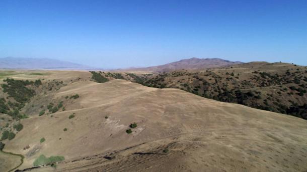
A drone captured images of Tugunbulak in 2018. (Michael Frachetti/Nature)
Ancient Cities Pop Out of a Desolate Landscape
Using the latest version of Lidar technology, a team of experts led by Michael Frachetti, professor of archaeology in Arts & Sciences at Washington University in St. Louis, and Farhod Maksudov, the director of the National Center of Archaeology in Uzbekistan, were able to accurately map the scale and layout of the sites of these two cities, which have been identified as Tashbulak and Tugunbulak.
While the landscapes that surround them are desolate now, 1,000 years ago and before, these communities were thriving trade outposts, despite their high-altitude settings and remote geographical locations. The city of Tashbulak covered about 30 acres (12 hectares) of land, while the much larger city of Tugunbulak was approximately 10 times as big.
“Documentation of extensive urban infrastructure and technological production among medieval communities in Central Asia’s mountains – a crucial nexus for Silk Road trade networks – provides a new perspective on the participation of highland populations in the economic, political and social formation of medieval Eurasia,” the study authors wrote in a paper about their study published in the journal Nature.

A drone captured images of Tugunbulak in 2018. (Michael Frachetti/Nature)
A Deep Dive into the Hidden Heart of the Silk Road Network
Lidar (light ranging and detection) has always been an ideal technology for exploring ancient urban landscapes covered by sediment and obscured by vegetation. That has made it especially useful in places like Mexico and Central America, where the lost cities of the Maya, Olmecs, and Aztecs are frequently covered by thick forest.
But the latest technological advancements have helped expand the scope of Lidar’s usefulness. Light ranging and detection equipment attached to drones or small unmanned aircraft systems are producing high-resolution images that reveal significant ground level details at difficult-to-explore remote archaeological sites.
“Unscrewed aerial vehicle/drone Lidar scanning has markedly improved the resolution of three-dimensional point clouds, allowing for the detection of slight traces of structural features at centimeters of detail across large archaeological sites, a method particularly useful in areas such as mountains, where rapid deposition and erosion irregularly bury and expose archaeological remains,” the study authors explained in their Nature article.
The high-res Lidar images from Uzbekistan produced a stunningly detailed view of the features of the two cities, even though they’d been covered over by significant deposits of soil and debris. The researchers carefully processed and examined the images, which were collected during 17 drone-based Lidar scans over a three-week period, and they were able to identify the outlines of roads, homes, fortifications, plazas, and public buildings that would have been constructed between the sixth and 11th centuries.
These cities were actually first identified between 2011 and 2015, during foot surveys in areas where computer models predicted ancient highland settlements might be found. The searches took place along the trail of the ancient Silk Road, which functioned as both an international trade route and a magnet for community builders who wanted to take advantage of the Silk Road network’s bustling economic activity.

Tugunbulak, 2022 excavations of medieval pottery. (Michael Frachetti/Nature)
“These would have been important urban hubs in central Asia, especially as you moved out of lowland oases and into more challenging high-altitude settings,” Frachetti said in a Washington University press release published on Phys.org. “While typically seen as barriers to Silk Road trade and movement, the mountains actually were host to major centers for interaction. Animals, ores, and other precious resources likely drove their prosperity.”
Despite their commercial orientation, these ancient cities still had unique identities that emerged from the survival requirements of living in the mountains far away from other settlements.
“This site had an elaborate urban structure with specific material culture that greatly varied from the lowland sedentary culture,” Maksudov said.
“It’s clear that the people inhabiting Tugunbulak for more than a thousand years were nomadic pastoralists who maintained their own distinct, independent culture and political economy.”
Early excavations in Tugunbulak suggest that one large fortress, which is protected by thick rammed earth walls, might have been a factory where metal workers turned iron ore into steel. If this is true Tugunbulak would have been a popular destination for traders looking to transport and sell steel at locations up and down the Silk Road.
“The Silk Road wasn’t just about the endpoints of China and the West,” Frachetti emphasized. “Major political forces were at play in Central Asia. The complex heart of the network was also a driver of innovation.”
The Wonders of Lidar Revealing the Wonders of the Medieval World
According to the researchers, without Lidar technology they still wouldn’t know much about what life was like in Tashbulak and Tugunbulak during the Silk Road days.
“These are some of the highest-resolution lidar images of archaeological sites ever published,” Frachetti said. “It would have taken us a decade to map such large sites manually.”
Frachetti and several graduate students sorted through all the Lidar data obtained during the 17 drone flights in the Spatial Analysis, Interpretation, and Exploration (SAIE) Lab at Washington University, ultimately turning it into 3D models that were passed to other members of the research team for further analysis. With the assistance of special computational algorithms specifically designed to scan archaeological surfaces and predict likely architectural alignments, the research team was able to create a detailed map of what Tashbulak and Tugunbulak would have looked like when they were fully functioning and occupied settlements in the first millennium AD.
In the future, Frachetti hopes to combine onsite exploration with drone-base Lidar imagery to find and model other high-altitude settlements along the 4,000 mile (6,400 kilometer) length of the ancient Silk Road.
“We could really change the map of urban development in medieval Asia,” he said.
Top image: Composite lidar view of Tugunbulak. Source: SAIElab/J.Berner/M.Frachetti/Nature
By Nathan Falde
!function(f,b,e,v,n,t,s)
{if(f.fbq)return;n=f.fbq=function(){n.callMethod?
n.callMethod.apply(n,arguments):n.queue.push(arguments)};
if(!f._fbq)f._fbq=n;n.push=n;n.loaded=!0;n.version=’2.0′;
n.queue=[];t=b.createElement(e);t.async=!0;
t.src=v;s=b.getElementsByTagName(e)[0];
s.parentNode.insertBefore(t,s)}(window, document,’script’,
‘
fbq(‘init’, ‘1662024193926428’);
fbq(‘track’, ‘PageView’);
[ad_2]
Source link
#Lost #Silk #Road #Mountain #Cities #Revealed #Uzbekistan